La Chapelle Saint-Roch
Add to my favorites

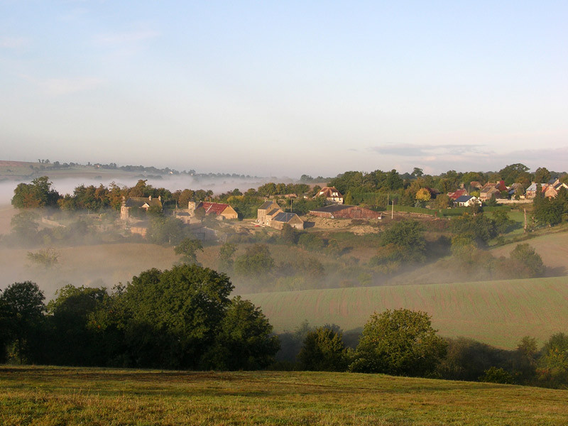
Vous êtes bien en Normandie ! Ces paysages, avec leurs escarpements aux formes arrondies, vous font penser à la montagne... Gravir les flancs de ces collines, plonger dans une vallée entrecoupée de ruisseaux et rivières, voilà un programme extrêmement alléchant pour tous les amoureux de randonnée.
The characteristics of the route.

PONT-D'OUILLY (14)
- Distance 11.01 km
- Elevation gain 320 m
- Elevation lost 320 m
- Min. elevation 46 m
- Max. elevation. 190 m
- Duration (depending on pace) 03:30:00
Report a problem
La_Chapelle_Saint_Roch All the routes on your smartphone
Download the Suisse Normande Outdoor mobile app
Get all the routes on your smartphone with the Suisse Normande Outdoor app. You'll find a host of functions:
- Take advantage of detailed IGN maps
- Download data for consultation even when you're not connected to the network
- Geolocate yourself at any time on the route and altimeter profile
- Activate the off-track alarm to be alerted if you stray from the itinerary
- Find nearby services
- Share your experience (add a report, share your lap time)...

stephan65
The 2025/08/14
En savoir plus
Ajouter votre chrono et partager vos sensations
2025/08/14 stephan65
Belle randonnée champêtre. Un peu de dénivelé mais possibilité d'une halte agréable au bord de l'eau à mi-parcours. Attention car le balisage est peu marqué et insuffisant, souvent en sens inverse par rapport au tracé gps. La carte sur l'application est bien utile.
2025/08/14 stephan65
Belle randonnée champêtre. Un peu de dénivelé mais possibilité d'une halte agréable au bord de l'eau à mi-parcours. Attention car le balisage est peu marqué et insuffisant, souvent en sens inverse par rapport au tracé gps. La carte sur l'application est bien utile.
Services nearby

Le Sablé d'Or
PONT-D'OUILLY
L'Epicerie du Coing
PONT-D'OUILLY

La Tribu des Cimes
LA POMMERAYE
Cave de la Loterie - Cidrerie de la Suisse-Normande
CLECY
Bergerie des Ber'Tommes
CLECY


Falaise - Suisse Normande Tourist Office
+33(0)2 31 90 17 26
Tourist Office
send mail
Suisse Normande Tourisme
+33(0)2 31 79 70 45
Tourist Office
send mail
![]()
Montagnes de Normandie
+33(0)2 31 59 13 13
Tourist Office
send mail
Val d'Orne Tourist Office
+33(0)2 33 35 86 57
Tourist Office
send mail
 Suisse Normande Outdoor - Parcours - La Chapelle Saint-Roch
Hello, world! This is a toast message.
Suisse Normande Outdoor - Parcours - La Chapelle Saint-Roch
Hello, world! This is a toast message.
Suisse Normande Outdoor - Parcours - La Chapelle Saint-Roch
Hello, world! This is a toast message.


OK
Annuler