
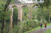
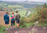
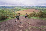
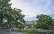
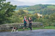
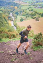
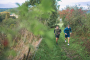
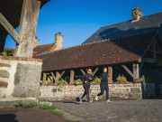
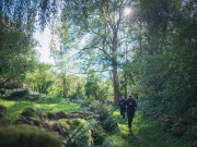
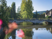
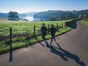
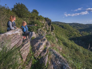
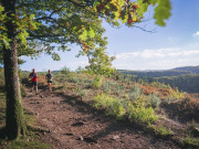
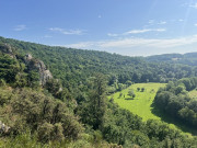
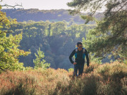
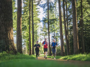
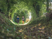
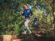
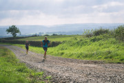
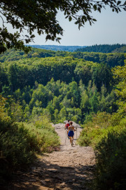
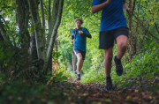
Suisse Normande Trail offers a unique and varied playground in the heart of exceptional natural surroundings. Between valleys, rivers and lush greenery, discover more than 30 marked trail-running routes, graded according to difficulty, as well as specific training workshops to help you train and progress in trail running. A range of routes designed for both beginners and experienced trail runners.
You'll also find all the trail activities on offer in Suisse Normande: courses, events, advice, practical information and services to help you organise and enjoy your trail experience all year round.


8.48km 150m 150m
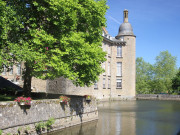
CLECY
15.49km 500m 500m
CLECY
19.82km 600m 600m
CLECY
40.77km 1260m 1260m
CLECY
8.34km 155m 155m
THURY-HARCOURT-LE-HOM
6.31km 300m 300m
THURY-HARCOURT-LE-HOM
17.16km 510m 510m
THURY-HARCOURT-LE-HOM
20.65km 610m 610m
THURY-HARCOURT-LE-HOM
35.98km 1060m 1060m
THURY-HARCOURT-LE-HOM
7.47km 164m 164m
PUTANGES-LE-LAC
17.56km 519m 519m
PUTANGES-LE-LAC
Route closed
23.43km 716m 716m
PUTANGES-LE-LAC
Route closed
6.66km 239m 239m
PUTANGES-LE-LAC
15.71km 536m 536m
PUTANGES-LE-LAC
11.24km 185m 185m
PUTANGES-LE-LAC
8.74km 152m 152m
PUTANGES-LE-LAC
22.5km 448m 448m
PUTANGES-LE-LAC
38.45km 995m 995m
PUTANGES-LE-LAC
Route closed
10.43km 327m 327m
SAINT-PHILBERT-SUR-ORNE
10.95km 355m 355m
SAINT-PHILBERT-SUR-ORNE
15.98km 554m 554m
SAINT-PHILBERT-SUR-ORNE
36.12km 923m 923m
SAINT-PHILBERT-SUR-ORNE
6.92km 122m 122m
ATHIS-VAL DE ROUVRE
15.75km 390m 390m
CERISY-BELLE-ETOILE
5.31km 210m 210m
CERISY-BELLE-ETOILE
7.63km 170m 170m
SAINT-PIERRE-DU-REGARD
17.21km 441m 441m
SAINT-PIERRE-DU-REGARD
11.88km 229m 229m
SAINT-PIERRE-DU-REGARD
29.33km 767m 767m
SAINT-PIERRE-DU-REGARD
11.06km 140m 140m
FLERS
8.79km 310m 310m
PONT-D'OUILLY
14.08km 392m 392m
PONT-D'OUILLY
24.57km 749m 749m
PONT-D'OUILLY
40.78km 870m 870m
PONT-D'OUILLY
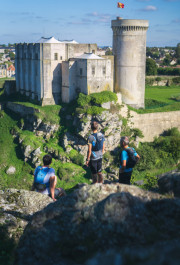
50.62km 830m 830m
FALAISE
7.59km 180m 180m
FALAISE


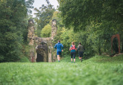
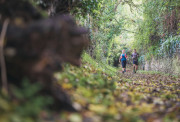
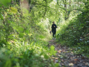
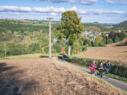
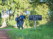
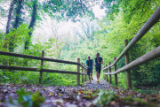
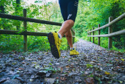
The routes are equipped with retro-reflective Trail markers. Each marker is labelled with the number(s) of the route to be followed and the colour of the difficulty (green - blue - red - black). Trail markers are placed at regular intervals, at each change of direction. Between two markers, follow the existing hiking markers.

Before running :
- Check the weather forecast before you leave, as itineraries can become dangerous in bad weather.
- Inform a friend or family member of your itinerary and planned times.
- Take water and food with you.
On the routes :
- Respect the natural and agricultural environments you pass through.
- Close the gates after you've passed through Stay on the trails
- All sections of the route on public roads are subject to the Highway Code, so be sure to obey it.
- Keep all garbage with you
Safety information : In the event of an accident, please contact the emergency services by dialing 112.

Falaise - Suisse Normande Tourist Office
+33(0)2 31 90 17 26
Tourist Office
send mail
Suisse Normande Tourisme
+33(0)2 31 79 70 45
Tourist Office
send mail
![]()
Montagnes de Normandie
+33(0)2 31 59 13 13
Tourist Office
send mail
Val d'Orne Tourist Office
+33(0)2 33 35 86 57
Tourist Office
send mail
 Suisse Normande Outdoor - TRAIL-RUNNING

