Sous le Mont d'Ancre
Add to my favorites

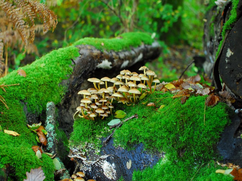
La vallée du Vingt-Bec, bordée de bois présente un aspect presque montagnard dû à un relief accentué. La forêt domaniale de Valcongrain enchante les promeneurs par ses cours d’eau, ses nombreux chemins creux et ses champignons !
The characteristics of the route.

THURY-HARCOURT-LE-HOM (14)
- Distance 13.25 km
- Elevation gain 340 m
- Elevation lost 340 m
- Min. elevation 96 m
- Max. elevation. 242 m
- Duration (depending on pace) 03:45:00
Report a problem
25. Sous le Mont d'Ancre 2024 WEB All the routes on your smartphone
Download the Suisse Normande Outdoor mobile app
Get all the routes on your smartphone with the Suisse Normande Outdoor app. You'll find a host of functions:
- Take advantage of detailed IGN maps
- Download data for consultation even when you're not connected to the network
- Geolocate yourself at any time on the route and altimeter profile
- Activate the off-track alarm to be alerted if you stray from the itinerary
- Find nearby services
- Share your experience (add a report, share your lap time)...

mimine27
finished in 03:00:00
The 2026/04/22
En savoir plus
Ajouter votre chrono et partager vos sensations
2026/04/22 03:00:00
mimine27
mimine27
super randonnée, très beaux paysages ! je recommande
2026/04/22 03:00:00
mimine27
mimine27
super randonnée, très beaux paysages ! je recommande
Services nearby

Ecurie des Monts - Le Hom Equitation
THURY-HARCOURT-LE-HOM
Club Multisports Thury-Harcourt
THURY-HARCOURT-LE-HOM

Le Quai d'Harcourt Café Epicerie Associatif
THURY-HARCOURT-LE-HOM
Thury Plein Air
THURY-HARCOURT-LE-HOM

Thury Plein Air
THURY-HARCOURT-LE-HOM


Falaise - Suisse Normande Tourist Office
+33(0)2 31 90 17 26
Tourist Office
send mail
Suisse Normande Tourisme
+33(0)2 31 79 70 45
Tourist Office
send mail
![]()
Montagnes de Normandie
+33(0)2 31 59 13 13
Tourist Office
send mail
Val d'Orne Tourist Office
+33(0)2 33 35 86 57
Tourist Office
send mail
 Suisse Normande Outdoor - Parcours - Sous le Mont d'Ancre
Hello, world! This is a toast message.
Suisse Normande Outdoor - Parcours - Sous le Mont d'Ancre
Hello, world! This is a toast message.
Suisse Normande Outdoor - Parcours - Sous le Mont d'Ancre
Hello, world! This is a toast message.


OK
Annuler