17 - Le défi des vallées
Add to my favorites

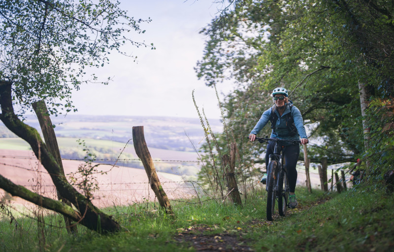
La Suisse Normande aux falaises rocheuses, parois abruptes, gorges et rivières encaissées font la joie des adeptes de sports de pleine nature. Cet espace sauvage se découvre à VTT ou VTTAE par ce circuit de 47 km. Son parcours au dénivelé de 1022 m lui prête des allures alpines et traverse des sites exceptionnels à vous couper le souffle !
The characteristics of the route.

THURY-HARCOURT-LE-HOM (14)
- Distance 47.91 km
- Elevation gain 1120 m
- Elevation lost 1120 m
- Min. elevation 19 m
- Max. elevation. 274 m
- Duration (depending on pace) 5h
- Suivre le balisage

Report a problem
All the routes on your smartphone
Download the Suisse Normande Outdoor mobile app
Get all the routes on your smartphone with the Suisse Normande Outdoor app. You'll find a host of functions:
- Take advantage of detailed IGN maps
- Download data for consultation even when you're not connected to the network
- Geolocate yourself at any time on the route and altimeter profile
- Activate the off-track alarm to be alerted if you stray from the itinerary
- Find nearby services
- Share your experience (add a report, share your lap time)...

Add your time and share your feelings
Services nearby

Le Quai d'Harcourt Café Epicerie Associatif
THURY-HARCOURT-LE-HOM

Kayak Club Thury-Harcourt
THURY-HARCOURT-LE-HOM
Thury Plein Air
THURY-HARCOURT-LE-HOM

Thury Plein Air
THURY-HARCOURT-LE-HOM
Club Multisports Thury-Harcourt
THURY-HARCOURT-LE-HOM


Falaise - Suisse Normande Tourist Office
+33(0)2 31 90 17 26
Tourist Office
send mail
Suisse Normande Tourisme
+33(0)2 31 79 70 45
Tourist Office
send mail
![]()
Montagnes de Normandie
+33(0)2 31 59 13 13
Tourist Office
send mail
Val d'Orne Tourist Office
+33(0)2 33 35 86 57
Tourist Office
send mail
 Suisse Normande Outdoor - Parcours - 17 - Le défi des vallées
Hello, world! This is a toast message.
Suisse Normande Outdoor - Parcours - 17 - Le défi des vallées
Hello, world! This is a toast message.
Suisse Normande Outdoor - Parcours - 17 - Le défi des vallées
Hello, world! This is a toast message.


OK
Annuler